
Quelle: Karte und Text Verwaltung Naturpark Westhavelland
Bewertungen

Wolfgang Hamann
18:57 17 Feb 26
Nun ist unser traumhafter Urlaub im Haus Mond bereits 6 Wochen her - aber besser als nie, möchte ich unsere Begeisterung über Familie Zemlin und die Ferienanlage kundtun.
Herrliche Lage, fantastische Unterkunft, absolute Ruhe, tolle Gastgeber, Ladesäule für's Auto direkt vor'm Haus - einfach alles perfekt!
Einzig der Schnee erhellte (leider) die dunkelste Stelle Deutschlands - und dennoch war es eine tolle Sternenführung!
Bei den Wanderungen war der Schnee wiederum herrlich: Zahlreiche Spuren vom Wild gab es zu lesen!
Wir kommen noch einmal wieder, idealerweise wenn
- Neumond ist
- und kein Schnee liegt
✨
-

Sabine Stephan
17:48 07 Jan 26
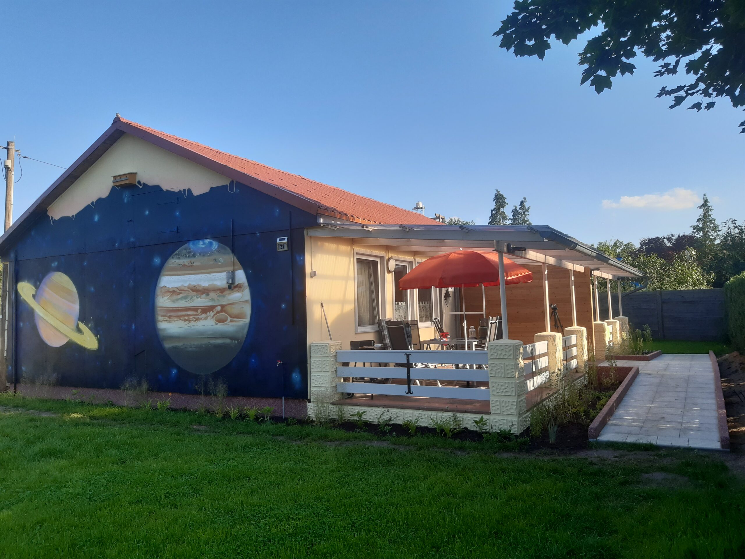
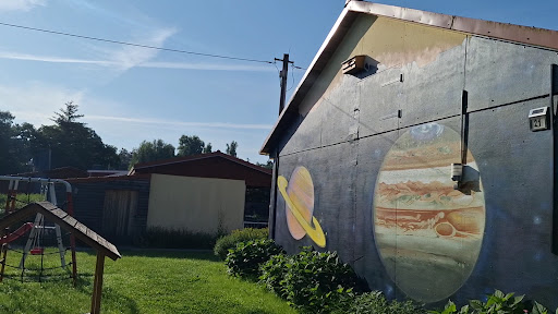
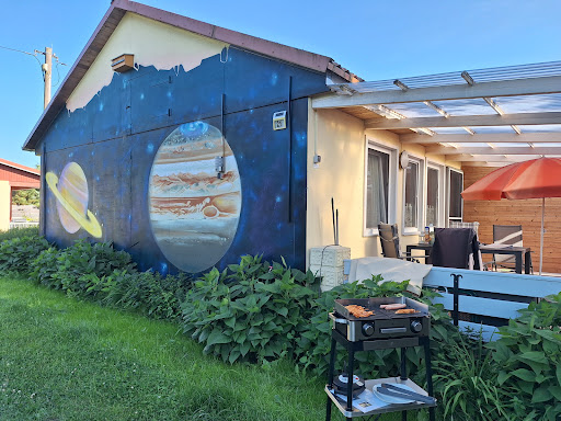
Die Ferienanlage ist sehr gut und Familie Zemlin ausgesprochen freundlich und hilfsbereit. Die Unterkunft, Haus Jupiter, war super schön. Es war alles da, was man so benötigt. Ich und meine Hündin hatten eine ausgesprochen ruhige und angenehme Zeit. Die Gegend ist wunderbar zum Laufen und Seele baumeln lassen. Wir werden bestimmt wieder kommen.

Ramona G
14:17 03 Nov 25
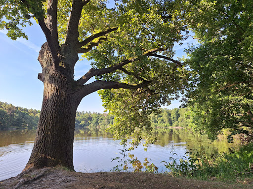
Wir hatten eine wunderbare Zeit im Bungalow Mond der Familie Zemlin. Die Lage ist traumhaft ruhig und liegt in einem Sternenpark – nachts sieht man hier wirklich einen beeindruckenden Sternenhimmel. Der Bungalow selbst ist sehr schön, gepflegt und vollständig barrierefrei, was den Aufenthalt unglaublich angenehm macht.
Ganz besonders hervorheben möchten wir die Gastgeber: herzlich, aufmerksam und immer hilfsbereit. Man hat das Gefühl, sie lesen einem jeden Wunsch von den Augen ab.
Wir haben uns rundum wohl und willkommen gefühlt.
Klare Empfehlung – wir kommen gerne wieder.
Ganz besonders hervorheben möchten wir die Gastgeber: herzlich, aufmerksam und immer hilfsbereit. Man hat das Gefühl, sie lesen einem jeden Wunsch von den Augen ab.
Wir haben uns rundum wohl und willkommen gefühlt.
Klare Empfehlung – wir kommen gerne wieder.

Laurids Koster
09:23 14 Sep 25
Wir haben ein wundervolles Wochenende im Sternenpark verbracht. Das Ferienhaus Milchstraße war ein Highlight und hat uns mit seinem Komfort und der tollen Ausstattung überzeugt.

Siegfried Frank
18:09 07 Aug 25
wer Ruhe und Entspannung sucht, wird sie in der Ferienanlage der Familie Zemlin finden.Auch bei nicht optimale Wetterbedingungen konnten wir interessante und schöne Ausflüge per Fahrrad und Auto unternehmen. Die Bungalows sind sehr gut ausgestattet. Der Höhepunkt der Ferienwoche war natürlich die Informationsveranstaltung über unser Weltall.Vielen Dank Familie Zemlin.

Bahar Hosseinzadeh
12:02 03 Aug 25
Wir waren gestern da und es war einfach richtig schön. Bei unserer ursprünglichen Buchung war der Himmel neblig, aber Liane und Detlef waren super herzlich und haben uns ohne Probleme einen neuen Termin ermöglicht. Das kleine Haus war sauber, gemütlich und mitten im Grünen. Die Sternführung war toll – ruhig, klar erklärt und wirklich besonders. Wir haben uns sehr wohlgefühlt und kommen gern wieder! 🌟

Susanne Schumann
06:31 25 Jun 25
Bereits zum zweiten Mal in dieser Oase und wieder begeistert. Das Wetter war diesmal perfekt zum Baden im fussläufig erreichbaren See.
Unser Haus Jupiter war mit allem ausgestattet was für einen entspannten Aufenthalt nötig ist. Betten sind bezogen 👍, Handtücher liegen bereit und über Spüli, Alufolie, Salz und Elektrogrill ist alles da.
Klamotten und Essen einpacken, losfahren und entspannen 🤗.
Vielen Dank fürAlles, liebe Frau Zemlin! Es war wieder sehr erholsam.
Vielleicht bis bald auf einen Dritten Besuch 👋👋

Christiane
20:10 12 Jun 25
Traumhaftes Ferienhaus in ruhiger Lage!

Jérôme
15:07 12 Jun 25
Wir waren 3 Nächte im Ferienhaus „Mond“. Die Ferienwohnung ist ein absoluter Traum, dort hat man alles was man braucht und sie ist sehr schön eingerichtet. Familie Zemlin ist sehr herzlich und immer für ein Plausch zu haben. Die Ruhe und Natur laden hervorragend ein zum Entspannen.

Constanze Kubacha
07:37 22 May 25
Wunderschönes Ferienhaus, tolle Ausstattung und sehr hoher Komfort. Sternenhimmel in Wohn-und Schlafzimmer. Vermieter bieten Sternenführungen an, sehr zu empfehlen. Tolle, ruhige Lage, See mir Naturbadestelle vor der Haustür.

Britta Ehlert
18:36 27 Apr 25
Wir haben unseren Kurzurlaub in der Ferienwohnung Milchstraße verbracht und waren wirklich sehr begeistert.
Die Wohnung ist modern und gemütlich eingerichtet. Alles war sehr sauber. Die Küche gut ausgestattet.
Highlights der Wohnung: die Deckenfenster über den Betten sowie der Sternenhimmel an der Wohnzimmer-Decke.
Die Sterne konnte man aber natürlich am besten draußen bei beobachten. Die Gastgeber haben ein eigenes Teleskop, durch das man den Sternenhimmel beobachten kann, was eine wirklich tolle Erfahrung war.
Wir empfehlen die Ferienhausvermietung Liane Zemlin auf jeden Fall weiter!

Julian Freigang
18:42 04 Apr 25
Wir waren das letzte März Wochenende für zwei Übernachtungen in einem der neu errichteten Ferienhäuser. Es hat uns sehr gut gefallen und es hat an nichts gefehlt! Liebevoll eingerichtet, sehr nette Gastgeber, schöne Natur und vor allem auch eine phantastische Möglichkeit in einen dunklen Sternenhimmel zu schauen.
Samstag Abend haben wir an einer Sternführung teilgenommen, die sowohl den Kindern als auch uns Erwachsenen lange in Erinnerung bleiben wird. Ein wenig durchgefroren haben wir uns unter der aufwendig gestalteten Wohnzimmerdecke aufgewärmt, unbeschreiblich!
Vielen Dank, wir kommen gerne wieder.
Samstag Abend haben wir an einer Sternführung teilgenommen, die sowohl den Kindern als auch uns Erwachsenen lange in Erinnerung bleiben wird. Ein wenig durchgefroren haben wir uns unter der aufwendig gestalteten Wohnzimmerdecke aufgewärmt, unbeschreiblich!
Vielen Dank, wir kommen gerne wieder.

Sas Si
15:39 17 Feb 25
Ich kann eine Auszeit in den Themen-Ferienhäusern der Familie Zemlin wärmstens empfehlen. Es ist hier schön ruhig, man kann die Natur genießen, Tiere beobachten und bei Dunkelheit und guter Sicht sogar den Sternenhimmel bestaunen. Die Sternenführung durch Herrn Zemlin hat uns sehr gut gefallen. Sehr informativ und dank professioneller Teleskope auch richtig interaktiv. Vielen Dank für die schöne Zeit! Wir kommen wieder.